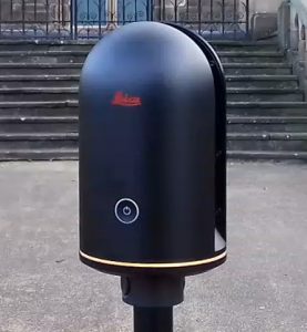
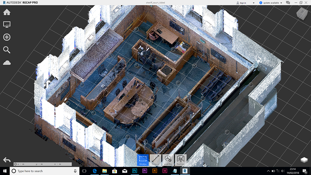
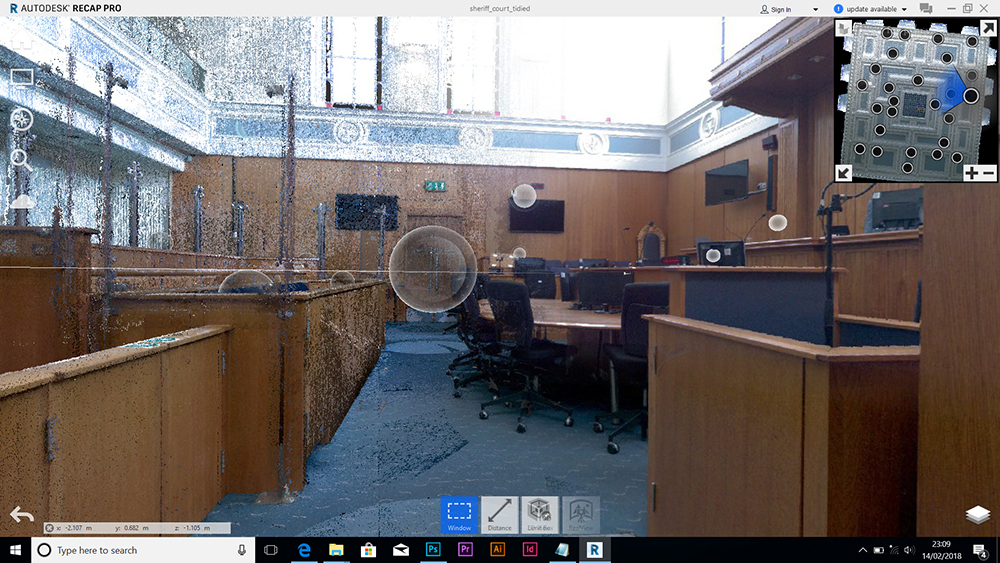
Sheriff Court, Dundee
We were given access to scan this space ahead of the filming of a documentary trial remake – the trial of William Burry – the last man to be executed at the court – hung by the neck until dead!
Scanning was flawless in this space – plenty of shapes made for excellent balance and the sun was not able to get directly in to the space for the most part so the lighting was most favourable. A lot of scans were needed due to the amount of occlusion by the low wooden dividers.
Here is a large A0 presentation sheet which shows the 6 ‘sides’ of this space.

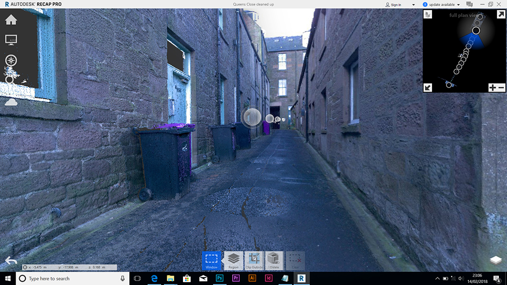
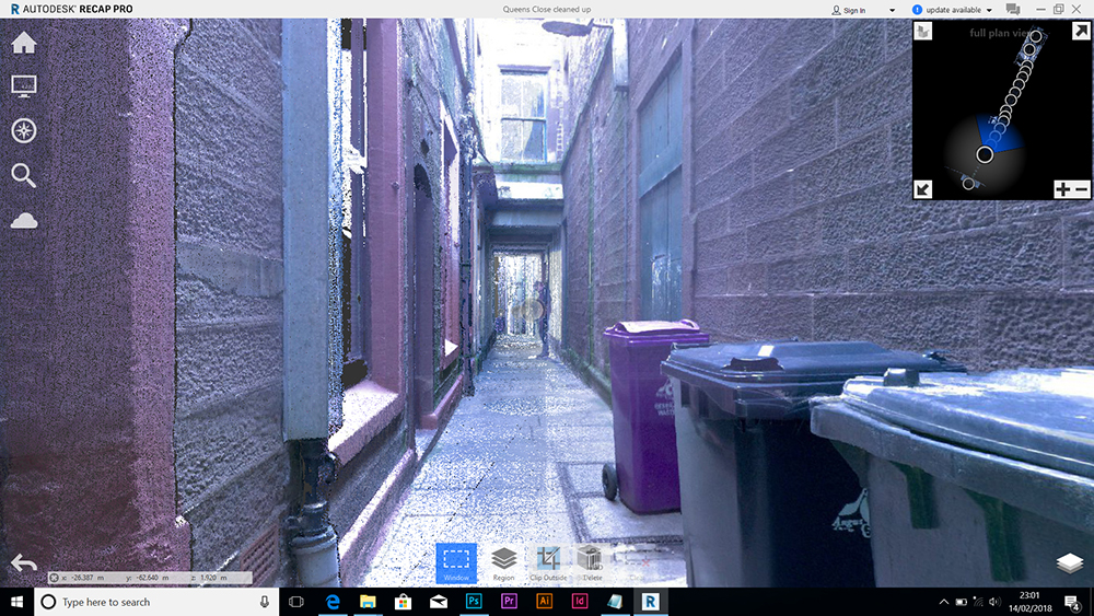
Queen’s Close, Montrose
This is the first scan of a narrow lane (locally called a close) which links the Montrose High Street to the hinterlands. I was instructing a student in the use of the BLK360 with the expectation that he undertakes similar scans to closes in Montrose and compares those to closes in St. Andrews which are of a different character.
FYI – The long narrow shape was especially tricky to get scans to register properly – the scans had to be done approx. 3 to 4 metres apart to get good overlap and good balance results. The sun was very bright and caused very strong contrast as we were down deep in the close – tricky conditions.
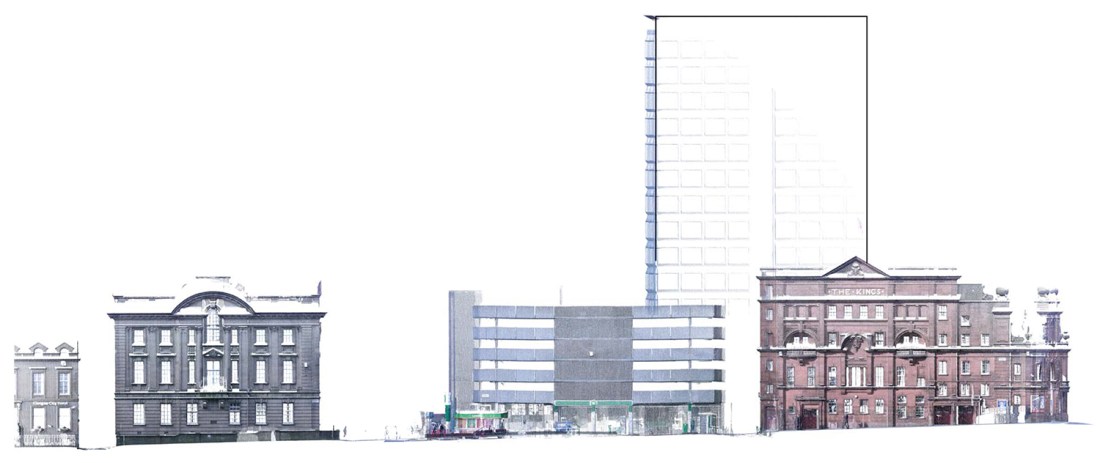
Here is a large A0 presentation sheet which shows each side of this space and a view from East to West. I am experimenting with printed outputs from AutoCAD. Selecting a point size which suits the printed architectural scale is the key to getting a legible printout.

Elmbank Street, Glasgow – Student Survey
This is the first major urban scan attempted, main street went very well indeed, perpendicular street was much more problematic due to us having buildings at our backs – very close and a lot of areas where we had not so much overlap.
Site location – principal street frontage highlighted:

I was pessimistic about scanning in such a busy urban location due to the number of vehicles and people that would cause interruptions but it was not too bad.
The range of the BLK360 was excellent as you can see it easily the top of the tall Premiere Lodge Hotel.
The student who I was helping (Tokini Kent) subsequently traced the scans in AutoCAD you can see the results here … link to A2 study sheet.
.
City Churches and Overgate area – Dundee
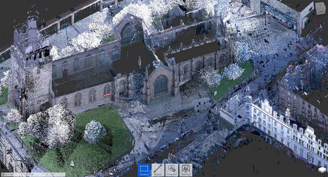
My first attempt at something on a much bigger scale in Dundee – I timed this so that it was just ahead of any leaves appearing on trees – here’s a video describing some of the problems I encountered.
May 2021 Update here: Over the last year of scanning I got more and more problems with large black missing portions in the 360 images – as described in the video above. I am not going to take the video down as it is useful to see the problem but I am now pretty certain this is down to interference from wifi signals AND my own hotspot signal preventing smooth flow of information from BLK360 to the iPad. Here’s what the BLK360 was contending with one day in Perth (during lockdown I might add) – there’s even a printer on that list. This is a screen grab from the iPad BTW.

I confirmed this one day in Dundee that was particularly horrible for doing on site registration – I went in to my college building, in to a lecture theatre which is a closed concrete and steel box, I did 6 scans and not a sign of any dropouts in the 360 photographs.
As mentioned elsewhere in this blog I actually prefer to not do onsite registration now, I do more scans on site (Push-Button) and take my time downloading and registering back at base. BLK360 – to iPad then to PC.
FYI you cannot accidentally NOT take photos if you are doing Push-Button scans – there’s no option to disable photographs for that method.
Dundee + Angus College Community Bus
A bizarre subject matter but this worked out really well. The college were gifted a used double decker bus so that they could take the college out in to the community – open days, fairs, events, etc.
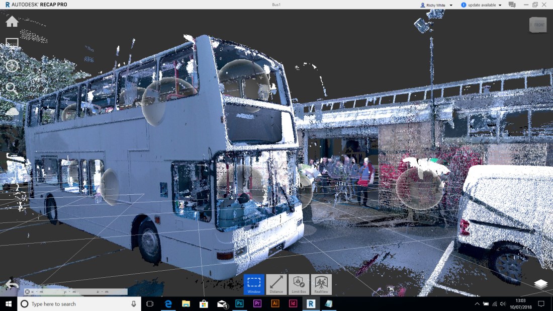
The architectural technology students were on hand to see the scanning process as were the vehicle maintenance students as they had done work on the bus – stripping out seats and the likes – which made scanning much easier. Here’s what it looks like sectioned along it’s long axis – note the very thin floor!

So that the students understood the process and what to do with the scans I made a couple of screen grabbed videos which you may find useful too:
Processing the scan and tidying up
Working with the scan in AutoCAD – controlling the UCS predominantly
The project is bidding for funding to take it to the next stage. Here’s a link to an AutoCAD drawing generated from the scan

.
